Flood Advisory, Watches and Warnings

Click on the links below to view the Advisory in your area

This page last updated on:  12/11 - 7:39 AM
NH A-1

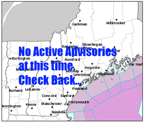
Flood statements for New Hampshire & Maine

Flood Watches/Warnings/Coastal Alerts

Flood Watch
National Weather Service Gray ME
316 AM EST Wed Dec 11 2024


.A widespread soaking rain is moving into the region and will continue through tonight. Warm temperatures will melt snowpack and increase river flows. Cold air on the backside of the system will slow runoff on Thursday and end overland flooding, however, river responses could last through the end of the week.

MEZ007>009-012>014-018>028-033-NHZ001>013-015-112030- /O.CON.KGYX.FA.A.0011.241211T1800Z-241212T1200Z/ /00000.0.IC.000000T0000Z.000000T0000Z.000000T0000Z.OO/ Northern Oxford-Northern Franklin-Central Somerset-Southern Oxford-Southern Franklin-Southern Somerset-Interior York-Central Interior Cumberland-Androscoggin-Kennebec-Interior Waldo-Coastal York-Coastal Cumberland-Sagadahoc-Lincoln-Knox-Coastal Waldo- Interior Cumberland Highlands-Northern Coos-Southern Coos- Northern Grafton-Northern Carroll-Southern Grafton-Southern Carroll-Sullivan-Merrimack-Belknap-Strafford-Cheshire-Eastern Hillsborough-Interior Rockingham-Western And Central Hillsborough- Including the cities of Limington, Kittery, Seboomook, Northport, Wolfeboro, Peterborough, Andover, Owls Head, Crawford Notch, Hope, Windsor, Pittsfield, Bowdoinham, Knox, Canterbury, Embden, Cornish, Durham, Newry, Manchester, Ossipee, Phippsburg, Lincoln, Morrill, Colebrook, Tuftonboro, Plymouth, Millsfield, Waterville Valley, Newcastle, Greene, Holderness, Hanover, Camden, Rangeley, Surry, Madison, Livermore Falls, Jackman, Salem, Bridgton, Marlow, Turner, Barrington, Berlin, Gray, York Pond, Grantham, Charlestown, Conway, Buxton, Bristol, Palmyra, Littleton, North Conway, Albany, Avon, Bridgewater, Keene, Milton, Goffstown, Byron, Waldo, Jaffrey, Long Pond, Upton, Vassalboro, Palermo, Nashua, Rollinsford, Temple, Derry, Claremont, Athens, Unity, Davis, Meredith, Sharon, Belfast, Newton, Rumford, Coburn Gore, Chesterville, Pelham, Oquossoc, Moosehead, Roxbury, Sanford, Cape Elizabeth, Wilsons Mills, Bethlehem, South Arm, Winterport, Gilford, Cornville, Arrowsic, Brunswick, Sullivan, Dover, Goodwins Mills, Locke Mills, Dresden, Laconia, Whitefield, Thornton, Woodstock, Plaistow, Alfred, Wales, Auburn, Dummer, Montville, Ellsworth, Hooksett, Jackson, Goshen, Concord, Moultonborough, Hampstead, Damariscotta, Gorham, Sugar Hill, Exeter, Bremen, Phillips, Rockport, Croydon, Bryant Pond, Loudon, Lyme, Lewiston, Brookfield, Fryeburg, Weare, Dunbarton, Gilsum, Lincolnville, Westbrook, Rockland, Milford, Yarmouth, Alna, New Gloucester, Middle Dam, Augusta, Errol, Waldoboro, Thomaston, Amherst, Harrison, Boscawen, Hollis, Topsham, Lempster, Atkinson, Brooks, Portland, Berwick, Mont Vernon, Lebanon, Madbury, Jay, Newport, Old Orchard Beach, Lancaster, Rumney, Brassua, Naples, Ashland, Liberty, New Portland, Norway, Wakefield, South Portland, Chester, Milan, New Sharon, Rochester, Boothbay Harbor, Somersworth, Bath, New Vineyard, Sidney, Bingham, Bethel, Bowdoin, Kingfield, Wiscasset, Sabattus, Wilton, Appleton, Pittston Farm, Saco, Chatham, North Windham, Biddeford, Skowhegan, China, Searsmont, Farmington, Waterville, Oxford, and Minot
316 AM EST Wed Dec 11 2024

...FLOOD WATCH REMAINS IN EFFECT FROM 1 PM EST THIS AFTERNOON THROUGH THURSDAY MORNING...

* WHAT...Flooding caused by heavy rain, snowmelt, and ice jams is possible.

* WHERE...Portions of Maine, including the following areas, Androscoggin, Central Interior Cumberland, Central Somerset, Coastal Cumberland, Coastal Waldo, Coastal York, Interior Cumberland Highlands, Interior Waldo, Interior York, Kennebec, Knox, Lincoln, Northern Franklin, Northern Oxford, Sagadahoc, Southern Franklin, Southern Oxford and Southern Somerset and New Hampshire, including the following areas, Belknap, Cheshire, Eastern Hillsborough, Interior Rockingham, Merrimack, Northern Carroll, Northern Coos, Northern Grafton, Southern Carroll, Southern Coos, Southern Grafton, Strafford, Sullivan and Western And Central Hillsborough.

* WHEN...From 1 PM EST this afternoon through Thursday morning.

* IMPACTS...The combination of rain and snowmelt will result in widespread and potentially significant flooding. The heavy rainfall rates could trigger flash flood conditions. For northern streams river ice is expected to move and could result in ice jam flooding.

* ADDITIONAL DETAILS...
- A soaking rain of 2 to 4 inches is possible from through early Thursday morning. Snowmelt will contribute to the runoff. Additionally there are concerns of shifting river ice in the north. Rivers and streams could rise to significant levels.


PRECAUTIONARY/PREPAREDNESS ACTIONS...

You should monitor the latest forecast and be alert for possible Flood Warnings. Those living in areas prone to flooding should be prepared to take action should flooding develop.

Home Page
NH A-1

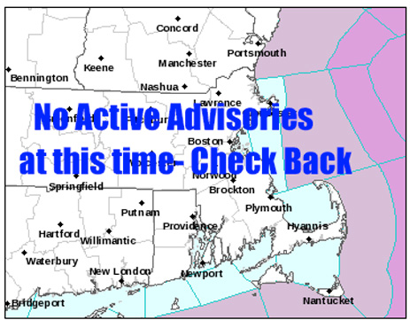
Flood statements for Massachusetts

Flood Watches/Warnings/Coastal Flood

Flood Watch
National Weather Service Boston/Norton MA
134 AM EST Wed Dec 11 2024


CTZ004-MAZ004-012-017>021-026-RIZ001>007-111945- /O.EXA.KBOX.FA.A.0008.241211T1800Z-241212T1200Z/ /00000.0.ER.000000T0000Z.000000T0000Z.000000T0000Z.OO/ Windham CT-Northern Worcester MA-Southern Worcester MA-Northern Bristol MA-Western Plymouth MA-Eastern Plymouth MA-Southern Bristol MA-Southern Plymouth MA-Northern Middlesex MA-Northwest Providence RI-Southeast Providence RI-Western Kent RI-Eastern Kent RI-Bristol RI-Washington RI-Newport RI- Including the cities of Foster, Putnam, Fitchburg, Taunton, New Bedford, Barre, Plymouth, Newport, West Greenwich, Coventry, East Greenwich, Narragansett, Ayer, Willimantic, Westerly, Smithfield, West Warwick, Brockton, Warwick, Mattapoisett, Fall River, Milford, Providence, Worcester, and Bristol
134 AM EST Wed Dec 11 2024

...FLOOD WATCH IN EFFECT FROM 1 PM EST THIS AFTERNOON THROUGH THURSDAY MORNING...

* WHAT...Flooding caused by excessive rainfall continues to be possible.

* WHERE...Portions of Northern Connecticut, Rhode Island and much of southeast Massachusetts.

* WHEN...From 1 PM EST this afternoon through Thursday morning.

* IMPACTS...A widespread 2-3 inches of rain is expected with localized 4"+ amounts possible through this evening. This may result in some small stream and mainstem river flooding. Heavy rain may also result in localized urban flooding and potentially impact part of the evening commute.

* ADDITIONAL DETAILS...
- Flooding is possible from excessive rainfall today and into this evening.
- http://www.weather.gov/safety/flood

PRECAUTIONARY/PREPAREDNESS ACTIONS...

You should monitor later forecasts and be alert for possible Flood Warnings. Those living in areas prone to flooding should be prepared to take action should flooding develop.

Home Page
NH A-1

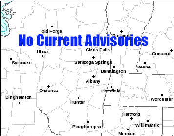
Flood Statements for Northeastern New York State

Flood Watches/Warnings

Flood Watch
National Weather Service Albany NY
327 AM EST Wed Dec 11 2024


CTZ001-013-MAZ001-025-NYZ043-053-054-084-VTZ013>015-120100- /O.CON.KALY.FA.A.0008.241211T1800Z-241212T1200Z/ /00000.0.ER.000000T0000Z.000000T0000Z.000000T0000Z.OO/ Northern Litchfield-Southern Litchfield-Northern Berkshire- Southern Berkshire-Northern Washington-Western Rensselaer-Eastern Rensselaer-Southern Washington-Bennington-Western Windham-Eastern Windham- Including the cities of Hancock, Gaylordsville, Hoosick Falls, Florida, Bennington, Dalton, Brattleboro, Troy, North Easton, South Egremont, Berlin, Pownal, Greenwich, Stamford, Oakville, Whitehall, Eagle Bridge, Stephentown, West Brattleboro, Bellows Falls, Granville, Woodford State Park, Sandisfield, Torrington, Guilford Center, North Adams, Cambridge, Terryville, Hudson Falls, Thomaston, Huletts Landing, Pittsfield, Fort Edward, Middle Falls, New Milford, Great Barrington, Londonderry, and Stratton
327 AM EST Wed Dec 11 2024

...FLOOD WATCH REMAINS IN EFFECT FROM 1 PM EST THIS AFTERNOON THROUGH THURSDAY MORNING...

* WHAT...Flooding caused by excessive rainfall is possible.

* WHERE...Portions of northwestern Connecticut, including the following areas, Northern Litchfield and Southern Litchfield, western Massachusetts, including the following areas, Northern Berkshire and Southern Berkshire, east central New York, including the following areas, Eastern Rensselaer, Northern Washington, Southern Washington and Western Rensselaer, and southern Vermont, including the following areas, Bennington, Eastern Windham and Western Windham.

* WHEN...From 1 PM EST this afternoon through Thursday morning.

* IMPACTS...Excessive runoff may result in flooding of rivers, creeks, streams, and other low-lying and flood-prone locations. Creeks and streams may rise out of their banks. Flooding may occur in poor drainage and urban areas.

* ADDITIONAL DETAILS...
- A low pressure system and a cold front will bring periods of moderate to heavy rain this afternoon into this evening before colder air returns to eastern New York and western New England. Mild temperatures will allow for at least some snow melt which will further add to the run off. There is also a chance of thunderstorms with downpours across some of the watch area. Isolated flash flooding and minor to moderate flooding of main stem rivers may occur. Total rainfall before a transition to snowfall Thursday morning will be one and a half to three inches in the watch area.
- http://www.weather.gov/safety/flood

PRECAUTIONARY/PREPAREDNESS ACTIONS...

You should monitor later forecasts and be alert for possible Flood Warnings. Those living in areas prone to flooding should be prepared to take action should flooding develop.


Home Page
NH A-1

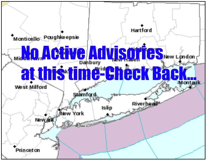
Flood Statements for NYC-Long Island and Coastal Connecticut

Flood Watches/Warnings/Coastal Flood

Flood Watch
National Weather Service New York NY
257 AM EST Wed Dec 11 2024


CTZ005>012-112100- /O.NEW.KOKX.FA.A.0011.241211T1800Z-241212T0600Z/ /00000.0.ER.000000T0000Z.000000T0000Z.000000T0000Z.OO/ Northern Fairfield-Northern New Haven-Northern Middlesex-Northern New London-Southern Fairfield-Southern New Haven-Southern Middlesex-Southern New London-
257 AM EST Wed Dec 11 2024

...FLOOD WATCH IN EFFECT FROM 1 PM EST THIS AFTERNOON THROUGH LATE TONIGHT...

* WHAT...Flooding caused by excessive rainfall is possible.

* WHERE...A portion of southern Connecticut, including the following areas, Northern Fairfield, Northern Middlesex, Northern New Haven, Northern New London, Southern Fairfield, Southern Middlesex, Southern New Haven and Southern New London.

* WHEN...From 1 PM EST this afternoon through late tonight.

* IMPACTS...A widespread 2 to 3 inches of rain is expected with localized 4 to 5 inches possible. The heavy rain may result in urban flooding and potentially impact the evening commute. Flooding on some of the quicker responding rivers, streams, and creeks is also possible.

* ADDITIONAL DETAILS...
- Flooding is possible from excessive rainfall this afternoon and evening.
- http://www.weather.gov/safety/flood

PRECAUTIONARY/PREPAREDNESS ACTIONS...

You should monitor later forecasts and be alert for possible Flood Warnings. Those living in areas prone to flooding should be prepared to take action should flooding develop.

Home Page
Subscribe to my Weather Alerts and get the Every Thursday Evening 'Weeked Outlook' E-mail. You manage your subscription. 

Cancel whenever you want.

BTW, we do not sell, trade, give away, post, whisper, dream about, tattoo, print or share your e-mail addresses with anyone...EVER!
When you subscribe, your address goes directly to me, not some online service.
Subscribe once and get all e-mails and warnings!
Yes, you can subscribe to multiple addresses, home, office etc.
Zero cost - No ads-No tracking
Questions/Issues/Problems/Say Hi: Contact me: E-mail

Add a RichLefko.com icon to your iPhone or iPad. It is easy. If you find yourself frequently visiting a website or using a web app on your iPhone or iPad, it is very easy to add a shortcut icon directly on your Home screen using Safari that you can quickly tap to launch the site. This is how:

How to Add a Website tile to Your iPhone or iPad Home Screen
Proud member of the National Weather Service Skywarn Program

Skywarn