My 25th Year Delivering Weather to New Englanders

Weather for New England & the Northeast
Sweet April showers, do spring May flowers.
- Thomas Tusser
- Thomas Tusser


Breaking Weather Headlines
Sunny - Mild Today
Mostly Clear Tonight

The new website upload will be delayed while I work out computer issues.
Scroll down for your three day forecast
If the advisory logo above is flashing, there are advisories you should be aware of.
Find the Daily Temperature trend graph here. Scroll to the bottom right.


New England Highs


New England Lows


Your Daily Forecast
Three Days at a time
Updates twice per day, weekdays, by 8AM and again by 7:30PM.
9AM and 7PM on Weekends.
Forecasts are for Southern NH (Nashua) to Keene NH with other locations noted.
(PB = Peterborough, NH) - (KE = Keene, NH)
The Weekend Outlooks are added every Thursday morning. (Forecasts through Sunday)
Warnings and/or Advisories

Hazardous Weather Outlook: Southern NH
Hazardous Weather Outlook
National Weather Service Gray ME
Issued by National Weather Service Caribou ME
352 AM EDT Wed Apr 23 2025
MEZ018-NHZ007>015-240800- Interior York-Sullivan-Merrimack-Belknap-Strafford-Cheshire- Eastern Hillsborough-Interior Rockingham-Coastal Rockingham- Western And Central Hillsborough-
352 AM EDT Wed Apr 23 2025
This Hazardous Weather Outlook is for southwest Maine, New Hampshire, central New Hampshire and southern New Hampshire.
Today and tonight.
Elevated fire weather conditions expected this afternoon due to gusty winds and dry conditions.
Thursday through Tuesday.
Hazardous weather is not expected at this time.
Direct Advisory Links:
Click the wobbling button below if a single advisory is active
The button below will be wobbling if there is a single advisory type. Click on the button and you will be taken to that page. If there are mutiple advisoies active, use the direct links above instead.
Click on this button if it is active (Wobbling)
Monday

Peterborough/Keene:
Monday Night

Peterborough/Keene:
Tuesday
Peterborough/Keene:
Tuesday Night
Peterborough/Keene:
Wednesday

Sunny, with a high near 70. Calm wind becoming west around 5 mph in the morning.
Peterborough/Keene:
Sunny, with a high near 64. West wind 5 to 10 mph.
Wednesday Night

Mostly clear, with a low around 42. Calm wind.
Peterborough/Keene:
Mostly clear, with a low around 39. West wind around 5 mph becoming calm.
Thursday
Sunny, with a high near 74. Calm wind becoming southwest around 5 mph in the afternoon.
Peterborough/Keene:
Mostly sunny, with a high near 69. Calm wind becoming southwest around 5 mph in the afternoon.
Thursday Night

Partly cloudy, with a low around 53. South wind around 5 mph.
Peterborough/Keene:
Partly cloudy, with a low around 50. Southwest wind around 5 mph becoming calm.
Friday

Partly sunny, with a high near 75. Calm wind becoming southeast around 5 mph in the afternoon.
Peterborough/Keene:
Partly sunny, with a high near 72. Calm wind becoming south around 5 mph in the afternoon.
Friday Night

Showers likely, mainly after 2am. Mostly cloudy, with a low around 51. Chance of precipitation is 60%.
Peterborough/Keene:

Showers likely, mainly after 2am. Mostly cloudy, with a low around 50. Chance of precipitation is 70%.
Saturday
Peterborough/Keene:
Saturday Night
Peterborough/Keene:
Sunday
Peterborough/Keene:
Sunday Night
Peterborough/Keene:
More weather information, local and around the world
New England Weather Discussion
(With thanks to the surrounding National Weather Service Offices)
Current Weather Readings:
(FYI: The number in parenthesis below is the change in the last hour)
-
Time of the readings below: 23 Apr 2025 2:49 PM
-
Current Temperature: 66.5°F (1.3)
-
High Temperature for today: 66.5 at 2:48 PM.
-
Low Temperature for Today: 43.9 at 5:41 AM.
-
Rainfall Today: 0.00 inches
-
Current Dewpoint Temperature: 34.1°F (1.1)
-
Hours of Daylight Tomorrow: 13:48
-
Lowest Windchill Reading Today: 43.9 at 5:41 AM
Last Complete Site Update: 4/23 - 6:20 AM
A Sunny, quiet, Spring Day ahead.
Rich`s Weather Discussion
I am expecting a new computer at some point. When it arrives there will be disruptions to the site update schedule, updates, my weather instrument feeds, etc.
As anyone who has done a computer data migration is aware, these things can go easy, or be a mess. So FYI for now.
The new website will go up once things settle down.
A sunny, pleasant, spring day ahead. In fact, the weather looks good into Friday with our next chance of showers Friday night into Saturday.
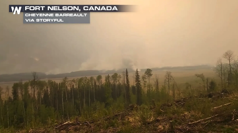
Dark smoke billowed near the Jersey Shore yesterday as a fast-moving wildfire forced thousands to evacuate and closed a portion of a major highway. The Jones Road Wildfire was sparked in the Greenwood Forest Wildlife Management Area close to Barnegat Township in Ocean County, and had burned 13.2 square miles of land by last night, according to officials with the New Jersey Fire Service, who said the fire is currently 10% contained. More than 1,300 structures were threatened, and around 3,000 residents have been evacuated.
The pollen count is high. See the numbers in Weather Graphic #3.
On this day in 2005, YouTube co-founder Jawed Karim uploaded the platform's first video, Me at the zoo, marking the humble beginnings of what would become the world's largest video-sharing site.
Near Term through Tonight
An upper-level disturbance, called 500 millibar shortwave energy, is rotating through Northern New England. Surface high pressure is located to the southwest. Morning fog formed due to moisture trapped in the lowest layer of the atmosphere, but it will mix out as the sun rises.
Winds from the west and northwest will bring dry air from Quebec into the region. Central and southern New Hampshire along with southwest Maine will experience downslope wind off the terrain, leading to mostly sunny skies. Upslope areas of the White Mountains and Longfellow Mountains will see more clouds as stable air is lifted by the terrain. A sprinkle is possible, especially in upslope regions of Franklin and Somerset counties in Maine, though any mountain could see one.
In the sunny downslope areas, the atmosphere will be mixed up to about 5000 feet. Forecast soundings, which are vertical profiles of atmospheric conditions, show the mixed layer tapping into winds of 15 to 25 knots around the 900 millibar level, roughly 3000 feet above sea level.
Fire weather concerns are present in southern New Hampshire, including the Monadnock Region, Merrimack Valley, Lakes Region, and interior Seacoast. Interior southwest Maine is also experiencing dry conditions. Forecasters included drier than average model data, specifically the 10th percentile from the National Blend of Models, to estimate dew points. This results in afternoon minimum relative humidity values around 20 to 30 percent in these regions. Winds gusting between 10 and 25 miles per hour along with low humidity increase fire weather risk. Elsewhere, relative humidity will be higher, ranging from 35 to 45 percent.
High temperatures will reach the mid to upper 60s in southern New Hampshire, with some locations like Manchester and Nashua reaching 70 degrees. In the Lakes Region and southern Kennebec Valley, highs will be in the low to mid 60s. Northern New Hampshire and the northwestern mountains of Maine will be cooler, with highs in the upper 40s to mid 50s. The Midcoast of Maine will see highs in the upper 50s to low 60s.
Tonight, high pressure will drift off the Cape Cod coast as upper-level winds become more west to east. Temperatures will fall into the 30s for most, with low 30s in the north and upper 30s in the south. The warmest areas, like the Merrimack Valley and the Seacoast, may stay in the low 40s. Winds will be light and variable with mostly clear skies.
Short Term Thursday
High pressure will continue drifting south of Georges Bank while an upper-level trough, or dip in the jet stream at the 500 millibar level, moves over Quebec. The day will be mainly dry until late afternoon, when rain chances increase from the northwest, affecting the northern half of the region.
Winds will shift to the south and southwest, drawing moisture from the Gulf of Maine. High temperatures in the mountains will be in the upper 50s to low 60s. Coastal Maine, the Midcoast, and the Kennebec Valley will also see low 60s due to the onshore wind. Southern and south-central New Hampshire along with the Lakes Region of Maine will warm into the upper 60s to low 70s with help from southwest winds.
Long Term Thursday Night through Tuesday
11 PM EDT Update: No major changes to the extended forecast. Models agree on scattered showers Thursday night and a more widespread rain event likely on Saturday.
Previous Discussion
Overview: High pressure will move into the Atlantic Friday. A low-pressure system will pass through the Great Lakes and into New England by Friday night into Saturday. This brings the most significant chance for rain during this period. High pressure is expected to return early next week.
Details: Dry conditions will continue into Friday as high pressure remains over the Atlantic. With clear skies and overnight cooling, temperatures could drop into the upper 30s or low 40s.
A weak upper-level disturbance, called a shortwave trough, will move across northern Maine Friday night. This may bring scattered showers and possibly a thunderstorm.
By Friday afternoon, return flow, which is air circling back toward the region around the high pressure, will increase as low pressure enters the Great Lakes. Forecasters are confident rain will develop over the weekend, although there is still uncertainty in the storm's exact path. Current model trends show the low pressure center staying south of the US and Canadian border, focusing rainfall over part of the region.
This system could include convective elements, meaning some showers could be heavier or produce thunder, especially Saturday afternoon or evening. Although the rain may briefly intensify, the system is expected to move out quickly. Drier weather should return by Sunday morning. Another area of high pressure will move in for early next week, and this system will be broader compared to the one earlier in the week.
Join my email list and get the EVERY THURSDAY EVENING E-mail blast that details the upcoming weekend weather. Plan ahead for the upcoming weekend! This is the same list I use for Winter Storm Warnings, hurricane alerts, and other weather hazards. It is free and mostly ad free. Cancel at anytime. I do NOT harvest e-mail addresses, nor do I sell them.
Site News
Welcome to my website!
Send me an E-mail if something is not working!
03/13/2025 - Weather Graphic 3 now shows the Allergy report
01/14/2025 -Working on Almanac Updates - Will appear in the updated site coming in March 2024
01/02/2025 - Work begins on a brand new site
Link to my weather instrument reading on Weather Underground - Weather Readings
Precipitation totals have been updated through November - Link
I have updated ALL contact me e-mail addresses on the site. If you tried one, and I did not respond, please try again. I ALWAYS respond.
Contact e-mail
Got a cool weather picture? Email it to me using the above address. Please let me know if I can use your name, and at the very least, include a location. Those pixs and video will be posted here: Storm Pix/Video Page.
I feature a 'Picture of the Week' every Friday. Do you have a great picture you would like to share? I would be happy to post your best shots in that weekly feature. Contact me if you are interested.
Traveling? A location in the world is posted every day in the USA/World Weather Section. Take a look at today`s place to avoid.
Regional Synopsis
SYNOPSIS... High pressure brings dry and seasonable conditions through the end of the work week. The next chance of rain arrives this weekend as low pressure tracks near New England. Best rain chances look to be on Saturday with drier weather for the tail end of the weekend.
SYNOPSIS...
Warm and dry today followed by a chilly night driven by radiational cooling. Rather mild and dry conditions continue with high pressure over New England to round out the end of the work week, though there is a low chance of a passing shower late Thursday evening/night for northern Massachusetts, majority of the region is dry. A system for Saturday brings the next chance for widespread rainfall, though exact details remain uncertainty. Drier conditions return late this weekend into early next week.
NEAR TERM /THROUGH TONIGHT/...
Key Messages...
* Seasonable day with lots of sun and light winds.
* Chillier night tonight outside of the urban centers.
SHORT TERM /THURSDAY/... Short Term
Key Messages...
* Warmer on Thursday with quiet and dry weather, save for the chance of a spot shower in NW MA in the evening.
LONG TERM /THURSDAY NIGHT THROUGH TUESDAY/...
Key Messages:
* Warm and mostly dry Friday, outside of a stray shower in northern Massachusetts Thursday evening/night.
* The next chance for widespread rain comes in Saturday, but there are uncertainties with the exact timing.
* Drier conditions Sunday into early next week.

Live Weather Link
See the current readings from my weather instruments here in Peterborough, NH by clicking on the Weather Vane Below.

Weather History for Today


Weather Headlines
Summer Arrives on Friday, June 20, 2025 at 10:42 PM
Quiet Into Late Week. Seasonably Mild Temps.


Temperature Trend

Rain Saturday

The Allergy Report - From Nashua to Keene


April Facts

Regional Weather Discussions
Updated once in the morning-These are provided by the NWS, WMUR-TV, or me...
Manchester, NH: Last update: 4/23 - 6:21 AM
More pleasant spring weather rolls on today, changes follow heading into the end of the week and for the weekend.
Sunny skies and pleasantly mild today as highs will be mostly in the 60s, near 70 in southern NH. A northwesterly breeze will go 10-20+ mph in the afternoon.
Fair skies tonight and cooling down into the 30s north and lower 40s elsewhere.
Sun to clouds on Thursday with a low chance of a passing shower in the afternoon. Quite mild (62-72), except cooler along the coast.
A mild feel again for Friday with increasing clouds and the chance for late day showers. Some rain likely on Saturday then windy and drier south with lingering spotty showers north on Sunday.
Picture of the week - New every Friday
OUR SUN ERUPTS

Your picture could be featured here-Ask me how?
Current Boston Radar Loop - All Radars

Climate Information (Peterborough, NH)
This section is updated every morning.
Last Update: 4/23 - 6:21 AM
The current average temperature spread for this time of year:
High: 57 Degrees
Low: 34 Degrees
Record High: 1902: 81 Degrees
Record Low: 1965: 22 Degrees
The Summits Forecast
THE FORECAST FOR MOUNT MONADNOCK, NH
Summits of Mount Monadnock and North Pack Monadnock Mountain
902 AM EDT Tue Apr 22 2025
...Recreation forecast for summits of Mount Monadnock and North Pack Monadnock mountain...
REST OF TODAY...Summits in and out of clouds late this morning, then becoming partly sunny. Highs in the lower 60s. West winds 10 to 15 mph with gusts up to 30 mph.
TONIGHT...Partly cloudy. Lows in the upper 30s. West winds 10 to 15 mph with gusts up to 30 mph.
WEDNESDAY...Mostly sunny. Highs around 60. West winds 10 to 15 mph with gusts up to 30 mph.
5 Day Temperature Run - Peterborough, NH


Patterns & Other Information


The latest National Weather Map direct from the NWS.


RichLefko.com Sponsors
Please patronize those running ads below - They are the lifeblood of RichLefko.com
Anrik Irrigation

My Longest Sponsor, I am pleased to present Anrik Irrigation. Anrik Irrigation is a full service lawn sprinkler company. They perform a variety of services, installation, maintenance, fall blow-out, spring start-ups, and offer a great brand of deicer for winter. Ask me!!
Freedom Cad Services

Freedom Cad offers PCB Design Services, Enginerring Services, and other value added services. They are headquartered in Nashua NH.
Freedom Cad Offers: PCB Design Services, Engineering Services, and Value Added Services.
Download their free eBook, The Printed Designer?Äôs Guide to Executing Complex PCBs. Download Now.
Joe Shimer.Com

I hold a Broker license in Massachusetts and New Hampshire. I have earned National Team Leadership Awards for the years of 2007, 2006, 2005, 2004, 2003, 2002, 2001, 2000, 1999, and 1998.
I adhere strictly to the Realtor Code of Ethics.
I offer Seller and Buyer Representation.
If you'd like to ask me about Joe, please feel free to send me an e-mail.
Peters of Nashua

Located minutes outside of Manchester, Peters Nissan of Nashua is the go-to Nissan dealer serving Nashua and the greater Manchester area including Salem, Peterborough, Concord, and Lowell. We are here to meet your every automotive need whether you are in the market for a new or a used model, require a car loan and financial assistance, or want routine service or extensive repairs. Our commitment is to customer, no matter what.
Peters of Nashua has been serving the areas automotive needs since 1955. Family owned and operated. They service ALL makes and models and I highly recommend them. Ask me
Patten Energy

Discover the Patten Energy Difference
At Patten Energy, our philosophy is simple. We believe that bigger is not always better! We are neighbors serving neighbors - where you?Äôll always be referred to by name, never as just another account number. We are dedicated to maintaining the personal touch and quality care only a family run business can provide.
I use Patten Energy, and I heartily endorse them.
Dan's Tutorials

If you own ANY Apple products, I can highly recommend Dan's Tutorials. I am a visual learner and Dan's vidoes walk you through each and every option whether you are using an iPad/iOS, or a Mac/Mac OS, or an Apple Watch. Dan has you covered on ALL Apple devices.
Scott Doremus - Woodworking and Home Improvement

Specializing in:
Decks, Sheds, Pergolas, Stairs, Doors, Windows, Barn Doors, Exterior Repairs, Plumbing, Light Electrical
Serving North Middlesex County MA and the Monadnock Region of New Hampshire
Call for a free estimate: 978-735-9223
Email Scott by clicking here
I have used Scott for repair work at my house. I can highly reccomend Scotts work, his prices are reasonable, and he actually calls you back! Please contact Scott for a free quote and tell him you saw his ad at RichLefko.com!
Help Those Affected by Natural Disasters


Help those who put their lives on the line for us

The Wounded Warrior Project
Every warrior has a next mission. We know that the transition to civilian life is a journey. And for every warrior, family member, and caregiver, that journey looks different. We are here for their first step, and each step that follows. Because we believe that every warrior should have a positive future to look forward to. There is always another goal to achieve, another mission to discover. We are their partner in that mission. Veterans and service members who incurred a physical or mental injury, illness, or wound while serving in the military on or after September 11, 2001. You are our focus. You are our mission.
Thank you!
Subscribe to my Weather Alerts and get the Every Thursday Evening 'Weeked Outlook' E-mail. You manage your subscription.
Cancel whenever you want.
BTW, we do not sell, trade, give away, post, whisper, dream about, tattoo, print or share your e-mail addresses with anyone...EVER!
When you subscribe, your address goes directly to me, not some online service.
Subscribe once and get all e-mails and warnings!
Yes, you can subscribe to multiple addresses, home, office etc.
Zero cost - No ads-No tracking
Questions/Issues/Problems/Say Hi: Contact me: E-mail
Add a RichLefko.com icon to your iPhone or iPad. It is easy. If you find yourself frequently visiting a website or using a web app on your iPhone or iPad, it is very easy to add a shortcut icon directly on your Home screen using Safari that you can quickly tap to launch the site. This is how:
How to Add a Website tile to Your iPhone or iPad Home ScreenProud member of the National Weather Service Skywarn Program
